Tsunami Hazard and Mitigation in Indonesia

(AR | 12/09/2022)


A tsunami is an exceptionally large ocean wave caused by an underwater earthquake, landslide, or volcanic eruption. And more rarely, a tsunami can be generated by a giant meteor impact on the ocean [1]. Tsunami (pronounced soo-nah-mee) is a Japanese word, tsu, meaning port or harbor, and nami, meaning wave. Tsunami waves can be exceedingly long, as much as 100 kilometers and come with a great wave height and travel speed. A tsunami can cross entire oceans without great loss of energy.

Indonesia is located at the meeting place of three earth’s tectonic plates, namely the Eurasian Plate, the Indo-Australian Plate, and the Pacific Plate. These plates will continue to move over time in different directions and movements [2]. Due to the pressure from Indo-Australia against the Eurasian plate and Pacific plate, there was subduction where the plate was gathering energy that went on and on until at some point the tectonic plate was no longer strong enough to withstand the pressure, resulting in a sudden release known as an earthquake. Earthquakes caused by plate shifts are called tectonic earthquakes. Tectonic earthquakes are the main cause of tsunamis in Indonesia.

Figure 1. Plate movement in Indonesia (Source: BMKG)

Based on the assessment of Tsunami Hazard in Indonesia by Australia-Indonesia Facility for Disaster Reduction (AIFDR) [3], almost all regions of Indonesia have the probability to be hit by a tsunami disaster.

Figure 2. Tsunami (0,5 – 3 m) Probability in Indonesia (Source: AIFDR)

In addition to the onshore tsunami hazard, an assessment in Indonesian offshore is also carried out and based on research “Assessment of tsunami risk to offshore platforms in Indonesia [4]”. Conclusions can be drawn that almost all the earthquakes that can happen in the Offshore Indonesian region can produce an extremely dangerous tsunami, and almost all offshore regions/zones have the same hazard level as each other.

Figure 3. Tsunami zones in Indonesia Archipelago (Source: A Y Baeda [4])

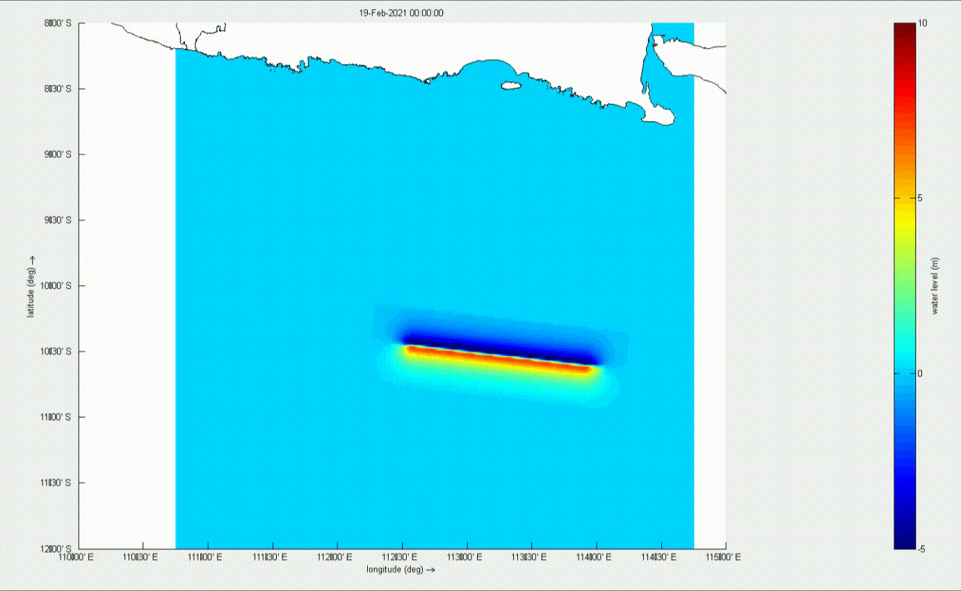
Of all the tsunami damages that has been reported in the literature, there are no known studies or references on destructive effects of tsunamis on offshore oil platforms, or whether any oil-fields workers were killed during a tsunami [4]. The impact given by the onshore tsunami is much greater than in the offshore. In the open water, the energy in a tsunami is distributed across its very long wavelength and short-wave height. As it moves into shallow water, essentially it stacks the wave up. The length becomes shorter, but the wave height becomes much larger and now it has a very tall, high-energy wave that is very dangerous in the nearshore. While a ship or a structure at sea might not feel a tsunami pass but the effects for ships and structures at the port when a tsunami hit can be devastating, ranging from damage to infrastructure to the loss of a person’s life. All the important locations could be in danger, such as crowded cities, small settlements, industrial areas, power plants, etc.

To overcome the problem of tsunami hazards in Indonesia, good disaster management is highly required. A tsunami is a disaster with a low frequency of occurrence but when it happens it has a significant impact. So, because of that, the most important thing in tsunami disaster management is to prepare preventive actions, mitigation preparations, and preparedness of the people.

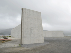
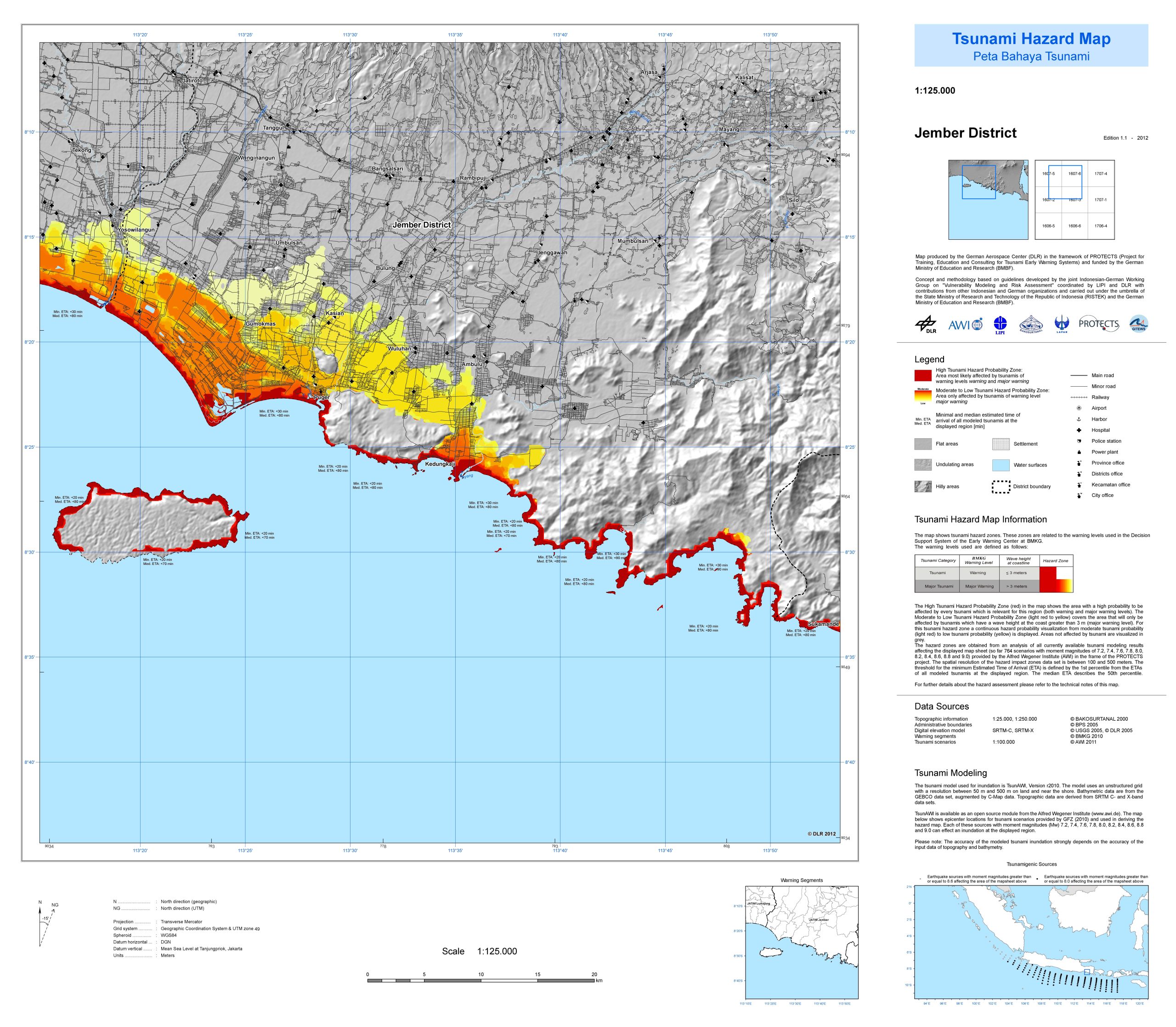
Preventive actions that can be taken are such as establishing an Early Warning System. Currently, Indonesia already has an early warning system for tsunamis, namely Ina-TEWS, Ina-TEWS is a comprehensive tsunami early warning system that collects all information from the results of earthquake monitoring, tsunami simulation, and tsunami monitoring. Ina-TEWS has two monitoring systems, which are a ground monitoring system consisting of seismometer network and a global positioning system (GPS) and a sea monitoring system consisting of buoys, tide gauges, and CCTV. These pieces of information gathered are used as consideration for the tsunami warning broadcasting using Decision Support System (DSS) Technology. When the early warning system calculates that there is a potential for a tsunami to occur, it will broadcast a tsunami warning to all elements of society involved within 5 minutes after the occurrence of an earthquake that has the potential to generate a tsunami. Another preventive action is to create a tsunami dike/seawall so that it can help the coastal area withstand the incoming tsunami waves. Another easier option is to create a barrier from mangroves that can absorb the energy from the tsunami waves. Other than that, for the offshore platforms, a proper structural design is necessary, for example it is preferable to provide a deck clearance of 5-10 ft above the surface to accommodate high waves that could possibly happen, but if the threat of tsunami hazard in the region is highly considered, the deck clearance of oil platforms is suggested to be higher [4].

Figure 5. Sea Wall on Ryori Bay, Iwate prefecture, Japan (Source: Wired)

To prepare for tsunami disaster mitigation, many studies can be done to reduce the impact of tsunamis, such as by calculating tsunami events statistics and modeling tsunami waves. A tsunami disaster can be modelled using a software. By modeling it, the area that has the potential to be hit by a tsunami disaster can be known, and how high the tsunami will arrive at the coast can be predicted. After modeling the tsunami, guides can be made, such as a tsunami hazard map that provides information for the public regarding which areas are potentially affected by a tsunami, and from the information provided by the model and the map, it can be used as a reference for making evacuation route map, where and how far to run, and the route to a safe place.

Figure 6. Example of tsunami modeling in Southern Area of East Java (Source: Armono et. al.)
Figure 7. Tsunami hazard map in Jember District (Source: GITEWS)
Figure 8. Tsunami Evacuation map in Padang City (Source: GITEWS)

For community preparedness, education needs to be intensified so that all elements of society are aware of the dangers of a tsunami disaster and understand what to do when a tsunami disaster occurs. For industry, preparedness is required in dealing with tsunamis, such as making evacuation assembly point signs, evacuation route/map signs, etc. Other than that simulation of disaster can be done like in the Sudimoro Pacitan power plant industry which is located on the south coast of East Java that has a high risk of being hit by a tsunami. They Collaborate with Badan Penanggulangan Bencana Daerah (BPBD) to do simulations of the earthquake and tsunami occurrence so that the people there are prepared when this unexpected thing really happens.

Figure 9. Earthquake and tsunami simulation training at the Pacitan, Sudimoro Power Plant (Source: Pacitan BPBD)

Indonesia has an immense potential to be hit by a tsunami disaster. A tsunami disaster can arrive at any time because no one can predict it, and it depends on how prepared all elements of society are for dealing with a tsunami disaster. In an effort to raise awareness of metocean hazard, BWGeohydromatics has the capability of providing hazard assessments including for tsunamis. Information on tsunamis could provide insight to help us determine the best design criteria in order to minimize the risk due to tsunami impacts such as tsunami inundation and run-up. That being the case, let us raise awareness of the tsunami hazard in Indonesia together.


Reference(s):

  1. Triatmadja, R. 2010. Tsunami: Kejadian, Penjalaran, Mitigasinya. Yogyakarta: Universitas Gadjah Mada.
  2. Palupi, I.R., W. Raharjo., E. Wibowo., dan H. Hamdalah. 2018. Pemodelan Tsunami Sederhana dengan Menggunakan Persamaan Differensial Parsial. Journal of Applied Physics. Vol 8 : 26
  3. Horspool, N., Pranantyo, I.R., Griffin, J., Latief, H., Natawidjaja, D., Kongko, W., Cipta, A., Bustamam, S.D.A. and Thio, H.K., 2013. A national tsunami hazard assessment for Indonesia. Australia–Indonesia Facility for Disaster Risk Reduction, Australian Government Department of Foreign Affairs and Trade, Canberra.
  4. Baeda, A.Y. and Carayannis, G.P., 2020. Assessment of tsunami risk to offshore platforms in Indonesia archipelago. In IOP Conference Series: Earth and Environmental Science (Vol. 419, No. 1, p. 012011). IOP Publishing.
  5. Armono, H.D. and Putra, A.R., 2021, December. Analysis of Tsunami Wave Height, Run-up, and Inundation in The Coastal of Blitar and Malang Regency. In IOP Conference Series: Earth and Environmental Science (Vol. 936, No. 1, p. 012013). IOP Publishing.