Wetter Than Usual: Analyzing Indonesia's Rainfall Predictions at the End of 2024 and Their Implications
(GF | 27/09/2024)
Indonesia is expected to experience a significant increase in rainfall towards the end of 2024, with wetter than usual conditions forecasted for the last quarter. This increase in rainfall is influenced by the La Niña, a cool phase of the El Niño-Southern Oscillation (WMO, 2024). NOAA predicts that La Niña will emerge in September to November 2024 (with a 71% chance) and is expected to continue through the January to March 2025 period (NOAA, 2024). High rainfall intensity can increase the risk of floods and disrupt maritime operations. For instance, CNBC Indonesia reported that over 300 Pertamina wells in the Rokan block were shut down, and access roads were blocked due to flooding during the December 2022 to February 2023 period [3]. The flood incident is predicted to occur due to heavy rainfall [4]. This incident highlights the importance of rainfall forecasts in enhancing mitigation strategies and preparedness for extreme weather. This article aims to provide an overview of rainfall predictions for the next few seasons.
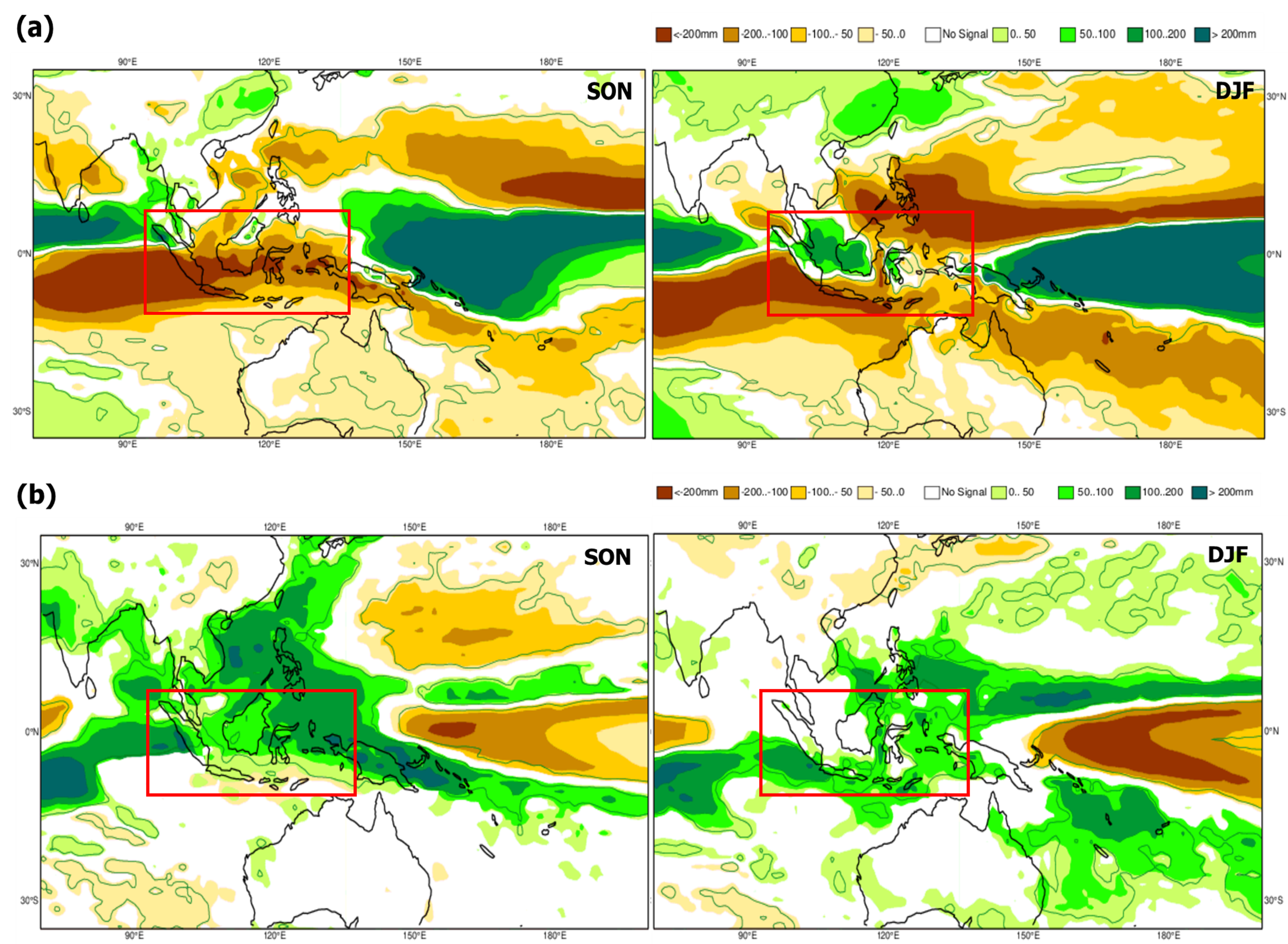
Based on climate forecasts from The European Centre for Medium-Range Weather Forecasts (ECMWF), the intensity of rainfall during the September 2024 to February 2025 periods is expected to be more intense than the September 2023 to February 2024 periods [4]. This indicates that almost all regions of Indonesia may experience wetter conditions, with the peak of rainfall predicted for October to November 2024. Rainfall levels are forecasted to rise by less than 50 mm above normal in Java, 50-100 mm in Sumatera and Kalimantan, and over 100 mm in eastern Indonesia, as shown in Figure 1.
Figure 1. Spatial map of mean precipitation anomalies (a) September 2022 to February 2023 (b) September 2024 to February 2025 (Source: ECMWF)
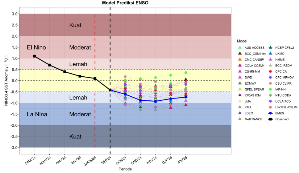
Climate phenomena such as the El Niño-Southern Oscillation (ENSO), influence rainfall patterns across different regions. The intensity of ENSO is measured using the Nino 3.4 index. According to BMKG reports, ENSO is expected to potentially develop into a weak La Niña starting in October 2024, with an index value of -0.7, as shown in Figure 2. La Niña is characterized by cooler sea surface temperatures (SST) in the central and eastern tropical Pacific Ocean compared to normal, accompanied by stronger easterly trade winds. During La Niña, rainfall generally increases by 20-40% compared to neutral years. However, some areas may experience more than a 40% increase in rainfall [6].
Figure 2. ENSO index prediction (Source: BMKG)
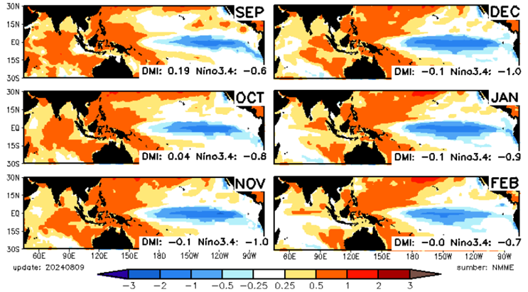
Additionally, the ECMWF’s precipitation anomalies prediction, which forecasts increased precipitation, is supported by sea surface temperature anomalies reported by BMKG [7]. The greater the sea surface temperature anomaly, the stronger its impact on increasing rainfall in Indonesia [8]. During the SON (September to November) period, most of Indonesia’s waters experience sea surface temperatures warmer than normal, including the Java Sea, Makassar Strait, Banda Sea, Seram Sea, and Timor Sea. These warmer temperatures can lead to increased evaporation rates, stronger convective systems, and a greater likelihood of extreme rainfall.
Figure 3. Spatial map of sea surface temperature anomalies (Source: BMKG)
In summary, the September 2024 to February 2025 periods is expected to bring wetter conditions across most of Indonesia compared to 2023. Stakeholders in maritime and resource management sectors should prepare for these changes, enhancing flood mitigation strategies and adjusting the operational plans. For continued updates and tailored weather insights, PT Bhumi Warih Geohydromatics is committed to providing the essential information needed for effective decision-making.