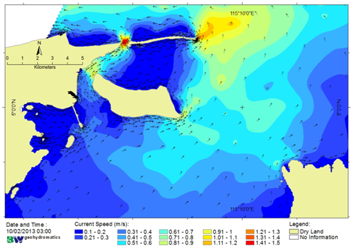
Port development at four points on Muara Besar Island, Brunei Darussalam require careful planning. Location of the island where inside Brunei Bay requires further study. Combining three side of analysis is expected can be used to support decision making.
These analyzes are as follow, Historical Data Analysis, 10 years of data are used to see patterns and trends of each MetOcean parameters (wind, waves, currents, and tides), either monthly or annual. Then the analysis of the two-month field data, the results of this analysis are expected to have a pattern that fits with the historical data for the month of the survey. This data is also considered as an accurate data that can be used as a reference to verify the simulation model. The last one is performed tide and tidal current simulations in the domain area (covering the whole of Brunei Bay), it aims to look at the processes MetOcean at the times and places that can not be represented by both historical data and field data.
