Meteorological and oceanographic information support safe and efficient marine operation and design of coastal and offshore contruction. In the recent years, devices and methods have advanced to enable procurement of meteorogical and oceanographic information with a more relaible quality.
Marine information services (MarIS) is a weather forecast application for offshore, port and coastal industry. MarIs can provide complete site specific forecasts once or twice-daily, seven day (168 hours) ahead of wind, wave and weather. Weather forecast updates are provided by email, telephone or fax.
MarIS provides solutions for all offshore operations including exploration and production, dredging, engineering and facilities solutions, subsea, transport, drilling and survey.
The accuracy of marine weathers prediction are vital for the planning and execution of offshore operations. Accurate weather forecast leads to safer, efficient offshore operations, and cost savings. Our non stop improvement of our in-house computing tools and data analysis packages have made us capable to handle increasing demand of quality of deliverables.
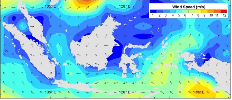
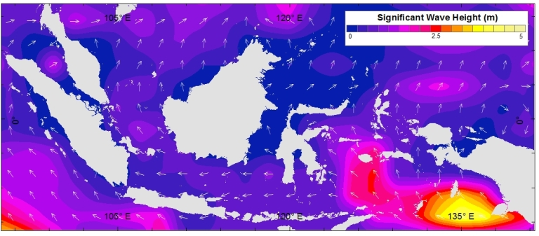
MarIS forecast service including wind speed, wind direction, wind gust, direction of the wave, significant wave height, weather chart and possibility of tropical cyclone. MarIS use statistical techniques to deliver accurate and reliable weather forecast. MarIS offers accurate weather forecasts for the world’s ocean (every 0.5 degree)
For further information about MarIS, please email maris@bwgeohydromatics.com
