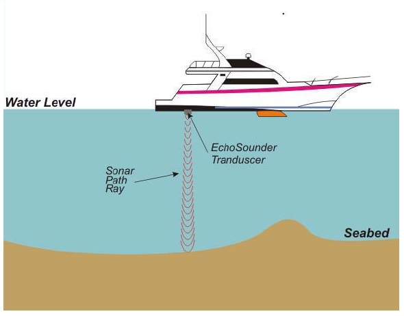
Topographical and Bathymetrical Survey Services were conducted to define the seabed and onshore conditions at the area of ANP. The survey include topographical survey, bathymetrisurvey, seafloor mapping (SSS, side scan sonar), shallow geological imagery (SBP, sub-bottom profiling), seabed sediment sampling (seabed samples), and oceanographic observations (tides, sea currents and temperature).
These data will be processed into an integrated information to gave the details about the seabed condition and shallow geological layers below the seabed and also to describe the tidal patterns and sea currents around the survey area.
The survey objective are:
- Identify the natural or man-made objects that should be considered during construction design and installation work;
- Define the shallow sub-seabed geological condition that should considered during the placement grooves screen pipe.
